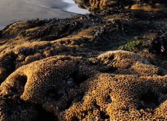
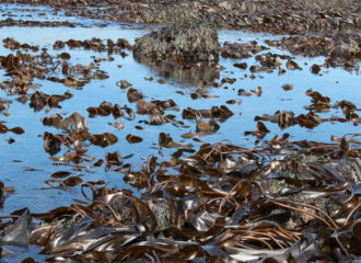
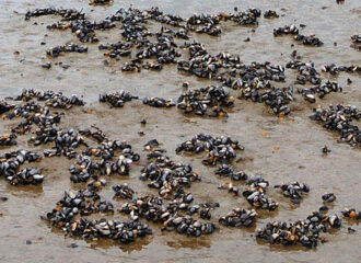
The intertidal rocky shore habitats tend to be split into five zones: the Splash Zone, the Upper Shore, the Middle Shore, the Lower Shore and the Infralittoral Fringe. Everything below these zones is sub-tidal and always covered by sea water. In terms of time spent inundated by sea water (which is proportional to the chances of the habitat being visible when satellite images are collected), the spray zone is never inundated though the species living in this zone (typically lichens and one or two species of periwinkle) will be subjected to salt water spray on the high spring tides. The Upper Shore, which is around the area of Mean High Water on spring tides, is the next most visible zone as it is only inundated during the relatively high spring tides. The Middle Shore, which is in the region of the Mean Tide Level, is visible for about 50% of the time and inundated for the other 50%. The Lower Shore. which is in the region of Low Water on neap tides, will spend most of the day covered by the sea. Finally, the Infralittoral Fringe is visible only during Low Water periods of spring tides and spends most of the year covered by sea water.