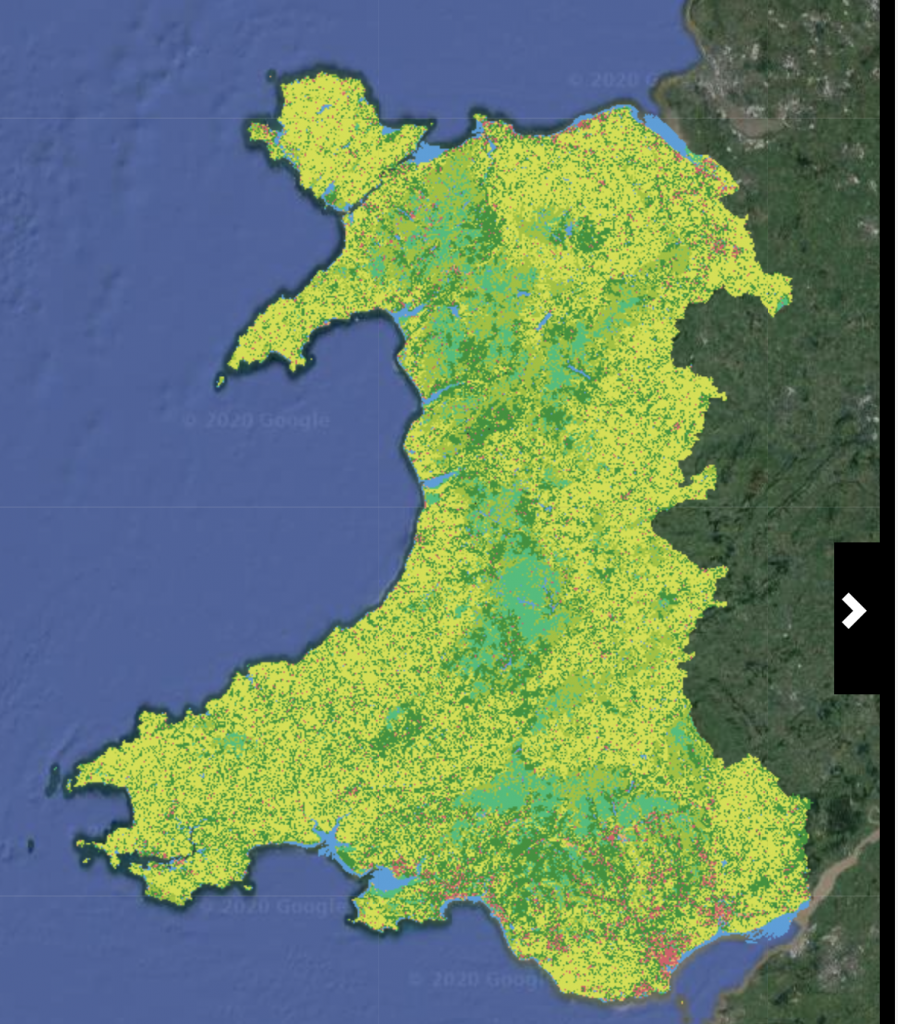
Living Wales is providing capability for routinely generating national 10-25 m land cover and evidence-based change maps from environmental descriptors retrieved from Earth observation (primarily satellite sensor) data. An overview of the Living Wales approach and relevance to Wales can be downloaded here and introductory and explanatory videos based on this presentation are available at the bottom of this webpage. Note that all maps are currently research products.
The Living Wales land cover and change classifications and environmental descriptors used for their generation are open access and freely available on our EarthTrack geo-portal. Layers will be continually added as they are produced and validated. Note that currently, several are only available for specific years (e.g., woody biomass, crop type). The classification codes are available here.
The spatial data can be accessed directly within common GIS software (e.g., QGIS, ArcGIS) through the Living Wales Web Map Server (WMS).
Through a collaboration with Plymouth Marine Laboratory (PML), Living Wales products are able to be displayed alongside other environmental layers within a dedicated portal (https://visual.pml.ac.uk/livingwales/). These include those relevant to marine and freshwater environments that are being produced as part of the NEODAAS and EOMORES projects at PML as well as those produced through Copernicus services and establishes connections with terrestrial environments. This provides a mechanism for browsing dense time series and performing simple analysis such as plotting and allows users to easily add new web services.
Ground data points that have been collected using the earthtrack mobile application are available at earthtrack.aber.ac.uk.